
In Los Angeles, hillside excavation can become complex when lot slopes reach Baseline Hillside Ordinance thresholds, often requiring stricter grading limits and certified slope calculations. Those limits can force teams to rethink foundation design, such as using caissons instead of spread footings to stay within allowable cut and fill. Costs rise with excavation, export, swell factors, and permit fees, while haul routes may need approval. Geotechnical data guides bearings, remedial work for expansive clay, and drainage plans, plus stormwater and tree compliance.
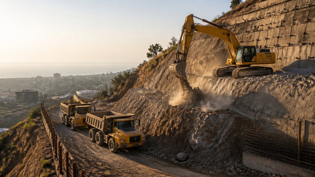
In Los Angeles, hillside excavation rules can begin to apply quickly once a property crosses certain slope and zoning triggers, and this is a major reason why hillside projects require early planning.
Properties with natural slopes of 15% or more, based on USGS topographic data, fall under Baseline Hillside Ordinance requirements, which are part of broader hillside regulations.
Zoning designations with hillside suffixes, such as R1-H or RE-H, can activate requirements even if the slope seems modest.
Multi-family zones on slopes above 5% also trigger protection.
City mapping systems and Hillside Area Maps determine applicability, so a lot may shift from non-regulated to regulated solely when the measured slope threshold is exceeded.
In these cases, excavation permits typically face stricter review.
Because excavation work is high-risk, fully insured contractors help protect clients from liability while work is performed under these more demanding conditions.
First, a property owner must determine the lot slope percentage using the required Slope Analysis Map, because hillside designation often begins at 15% and the slope bands influence permitting calculations. Next, they apply the baseline hillside grading limit by combining the 500 cubic yard base with an additional allowance equal to 5% of the total lot size in cubic yards, remembering this cap is based on combined Cut and Fill quantities rather than net change. Finally, the calculated amount is compared against zone-specific “by-right” limits from the applicable ordinance table, since those caps can restrict the maximum grading even when the formula suggests a higher number. This is why excavation contractors focus on rough grading to create the level or sloped surface needed for compliance.
To determine a hillside lot’s grading limit, the starting point is calculating the lot slope percentage using measured terrain data.
Using slope measurement techniques, the evaluator divides vertical rise by horizontal distance between two points, where vertical rise equals the highest point minus the lowest point. The highest and lowest elevations must be found through topographic survey work, with careful elevation point identification across the entire lot, not just a quick spot check.
Next, the linear distance between the extreme elevation points is measured, then the formula (Highest Point − Lowest Point) ÷ Distance Between Points = Slope % is applied.
A California registered Civil Engineer or Licensed Land Surveyor must prepare and certify the calculations, including license number and expiration date.
Once the lot slope percentage has been established, the next step is using the Baseline Hillside Formula to calculate the maximum hillside grading limit for the property. The approach starts with a base maximum of 500 cubic yards, then adds 5% of the total lot size, converted to cubic yards. It applies to all cumulative cut and fill, including incremental work on the same lot, and it supports grading regulations that manage environmental impact. For single-family residential zones in designated Hillside Areas, the calculated limit guides permit feasibility, since grading permits wait for building permit approval. The example below shows how the base and percentage combine.
| Component | Quantity |
|---|---|
| Base maximum | 500 yd³ |
| Plus allowance | 5% lot (yd³) |
| Example lot (5,000 sf) | 750 yd³ |
How can a property owner estimate the maximum hillside grading allowance before detailed engineering begins? First, they compare baseline and slope-based options using local grading regulations and a clear slope analysis map.
For standard eligible zones, the estimate starts with 500 cubic yards, then adds 5% of lot size in cubic yards. A 5,000 square-foot lot illustrates this, totaling 750 cubic yards (500 + 250).
Next, zoning caps can override the uniform estimate: R1 allows 1,000, RE9 allows 1,200, RE20 allows 2,400, RE40 allows 3,300, and RA allows 1,800.
Finally, if slopes are 30% or steeper for 60% or more, the minimal grading option applies, limiting grading to 10% of lot size or 1,000 cubic yards, whichever is less.
When a hillside lot has tight grading limits, the choice between conventional spread footings and caisson foundations can make or break the project’s feasibility.
During foundation selection, crews must align excavation techniques with Los Angeles grading rules that are set early in schematic design.
Conventional spread footings often demand extensive pad grading, which uses more of the grading allowance and can trigger regulatory follow-ups like ZAD applications.
On many LA slopes over 20%, geotechnical guidance pushes designers toward caissons.
Caisson excavation may be exempt from cumulative BHO totals, so the project can stay within limits even when more total earth is removed.
However, professional grading exempt remedial grading applies only to removal below existing grade, and exported material still brings logistics demands.
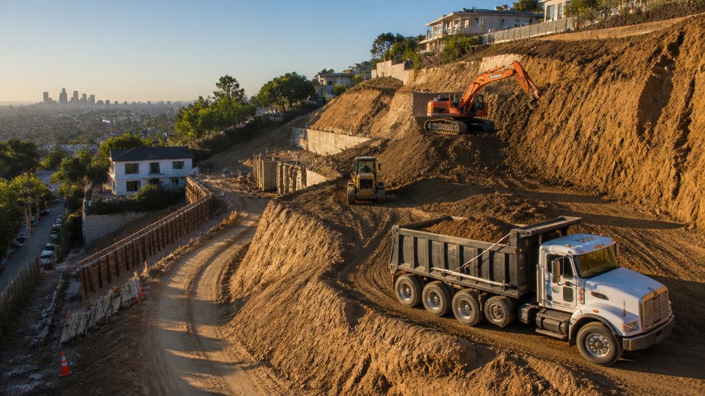
Budgeting hillside excavation requires looking beyond the “in-place” yardage shown on early estimates and separating it from what must actually be moved, hauled, and processed off site.
Basic cost estimation can start with $10–$25 per cubic yard in place, but excavation budgeting must add $15–$30 per cubic yard for material export, because trucking to disposal facilities is often unavoidable.
Swell factor of 20–30% means 1,000 in-place yards may require 1,200–1,300 yards of capacity.
Grading permits for work over 50 cubic yards, plus hillside regulations tied to slope percentage, can run $8,000–$45,000 and shift project timelines by 12–26 weeks.
Soil stability, site access limits, and foundation types such as caissons influence excavation techniques and raise export volumes.
Controlling haul routes and accounting for swell factor are two of the most practical ways to prevent hillside excavation delays before they start.
In Los Angeles, swell factor can increase loose volume by 20–30%, so a 2,000-cubic-yard in-place excavation may require 2,400–2,600 cubic yards of export volume, raising trucking capacity needs and disposal costs.
This directly affects project budgeting and excavation planning, since bids priced on in-place quantities often understate hauling by the same 20–30%.
Haul route approval is required for export volumes over 1,000 cubic yards, with DPW review in 21 days and possible hearings within 45 days.
Deputy inspectors perform compliance checks by counting trucks and verifying approved haul routes, supporting correct soil management and timing.
Geotechnical bearing results help teams plan which remedial grading steps are truly needed, and how to size and place engineered fill so loads stay within the intended support zone.
By identifying limitations like expansive clay behavior and depth of bearing material, the design can balance shallow versus deep foundation options while reducing risk of over-excavation surprises.
With these data in hand, the project can set practical excavation and compaction requirements, helping keep hillside construction both safer and more efficient.
Because hillside ground conditions set the limits for what foundations can safely support, geotechnical results largely determine both bearing design and the remedial grading scope.
In Los Angeles, geotechnical challenges from varied bedrock, colluvium, and undocumented fill force engineers to verify foundation stability early. Boring data and lab tests establish soil bearing strength, while LADBS requires certified foundation plans tied to those subsurface findings.
With slope factors meeting code requirements, the planned remedials match the actual ground conditions.
A key challenge in Los Angeles hillside construction is limiting the impact of expansive clay, since it can swell 10 to 30 percent as moisture changes and then shrink during dry periods.
With cyclical movement, the expansive soil can create differential expansion, driving floor heave, wall shifts, and foundation cracking.
Geotechnical testing before excavation helps identify highly expansive CH clay using borings, Atterberg limits, and swell-pressure results.
Engineers then use those geotech findings to guide soil remediation steps, including removing unsuitable material and placing certified fill to achieve reliable bearing.
For foundation stability, the plan relies on adequate factors of safety for static and, when required, seismic conditions, so structures resist uneven uplift.
Early, data-based decisions reduce long-term repair costs.
How should a hillside project decide between shallow foundations and deep foundations in Los Angeles, given that soil conditions can vary sharply from the slope face to the building footprint?
Geotechnical reports drive the choice by comparing stratification, groundwater, and hazards, and they direct soil testing for bearing and remedial planning. In expansive clay zones, mat foundations or deep piers may be needed to achieve reliable support.
Where liquefiable loose sands or shifting colluvium occur, caissons anchor the structure to resist settlement and lateral movement. In some areas, shallow bedrock complicates drilling and can require alternative foundation types.
Key checks include:

Staying compliant with stormwater rules and protected tree requirements is essential for hillside excavation projects, because both areas directly affect water quality and long-term site stability.
Proper tree preservation supports ecological compliance, while stormwater management and erosion control reduce sediment runoff. A SWPPP, often paired with SUSMP requirements, guides construction planning, including LID methods like infiltration and bioretention.
Onsite systems must be sized to infiltrate, store, treat, and keep discharge within site boundaries when feasible.
Meanwhile, grading regulations limit slope ratios and restrict cut areas, shaping site logistics and construction planning decisions. Protected species may trigger biological surveys, TPZ limits on equipment, and arborist-supervised grade changes.
Permits can take 90 to 120 days, so early environmental impact checks prevent delays.
A hillside grading permit is typically required even if excavation stays under 50 yards, because hillside design triggers enhanced scrutiny.
A permit may be waived only if the site is relatively level and approval is granted by the Department of Building and Safety.
If the work is entirely for footings and grade beams up to 5 feet deep, a waiver is more likely.
Any change to drainage, even small, can override the exemption.
Proper excavation techniques protect hillside stability.
To determine a lot’s slope percentage for ordinance requirements, first identify the highest and lowest elevations on the parcel using a stamped survey.
Then measure the linear distance between those points.
Compute slope as (Highest − Lowest) ÷ Distance, expressed as a percentage, and do not round up.
This slope measurement determines whether the lot falls in the 0–45% or >45% band, which controls the correct maximum RFA table.
To choose caissons versus spread footings, a licensed geotechnical engineer gathers soil composition, groundwater data, and stratification from borings. They then evaluate load capacity for both foundation types.
They also measure bedrock depth, expansion potential, liquefaction risk in seismic zones, and differential settlement potential. Laboratory tests should confirm bearing capacity and swelling characteristics, while slope movement and lateral forces determine whether deep anchoring is necessary.
Over-excavation raises total cost and export volume by increasing how much loosened soil must be hauled away.
Using swell calculation, crews convert bank volume to loose truck volume, often adding 20–50% more material.
If R&R and moisture conditions require removing unsuitable soils, additional export becomes unavoidable.
That swell-driven cost impact affects dump counts, haul routes, and disposal fees, so small bid errors can quickly become major losses.
Typical LADBS plan check or haul-route approval delays often stem from regulatory bottlenecks and documentation errors.
Missing or incomplete haul-route details, such as street designations, operating hours, dust control, or spillage mitigation, commonly trigger resubmittals.
Interdependent traffic and street-assessment reviews from other agencies can extend timelines, especially when responses are sequential.
Exceeding haul-volume thresholds also forces extra approvals.
Additionally, absent or outdated grading and geotechnical supporting documents slow reviewers’ decisions.
Hillside excavation in Los Angeles demands careful timing and smart decisions. First, teams calculate grading limits by slope, then they select footings or caissons to protect those limits. Next, they budget in-place versus export costs, and they control haul routes using swell factors to prevent delays. Finally, geotech results guide bearings and remedial work, while stormwater rules and protected trees keep projects compliant. When planning is precise, challenges become manageable, progress stays steady.
Skip to content